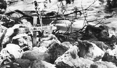
 Map of invasion beach. (click on image for an enlargement in a new window)
 Map of invasion beach. (click on image for an enlargement in a new window)
 Top map shows positions of Japanese defenses at time of Liberation.Bottom map shows, by date, the advance of U.S. forces in thrusting off beachheads and then driving north, pushing enemy forces into retreat. (click on image for an enlargement in a new window) Maps adapted by Ray Caseres


No comments:
Post a Comment